Analysis
Classification Algorithms
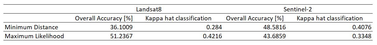
Minimum Distance
Minimum Distance algorithm calculates the Euclidean distance d(x,y) between spectral signatures of image pixels and training spectral signatures
Maximum Likelihood
Maximum Likelihood algorithm calculates the probability distributions for the classes, related to Bayes’ theorem, estimating if a pixel belongs to a land cover class.
Comparison between the classification algorithms
According to the figure above, Minimum Distance Algorithm performed better on Sentinel-2 than Landsat8 while Maximum Algorithm performed better on Landsat8 than on Sentinel-2. However, we decided to use Maximum Likelihood algorithm as on average the algorithm outperformed Minimum Distance Algorithm. Maximum Likelihood algorithm is also widely common to be used for land cover classification. 1
Accuracy Assessment
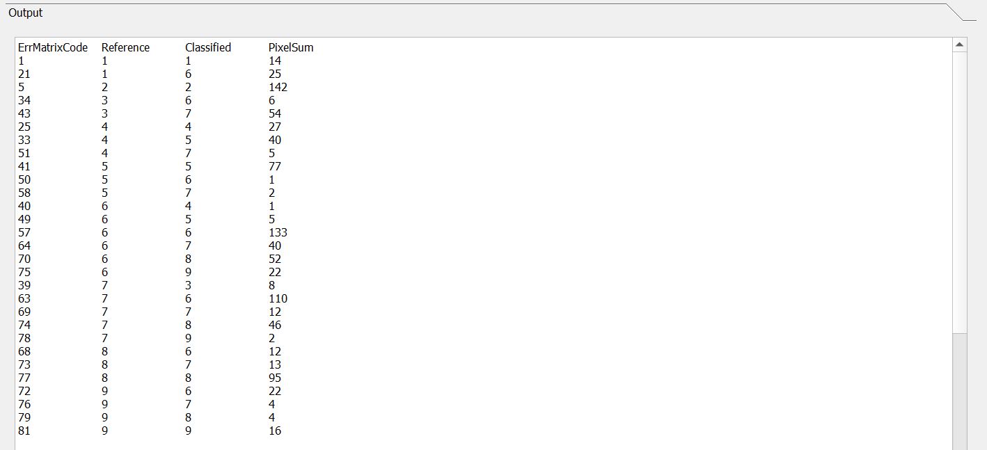
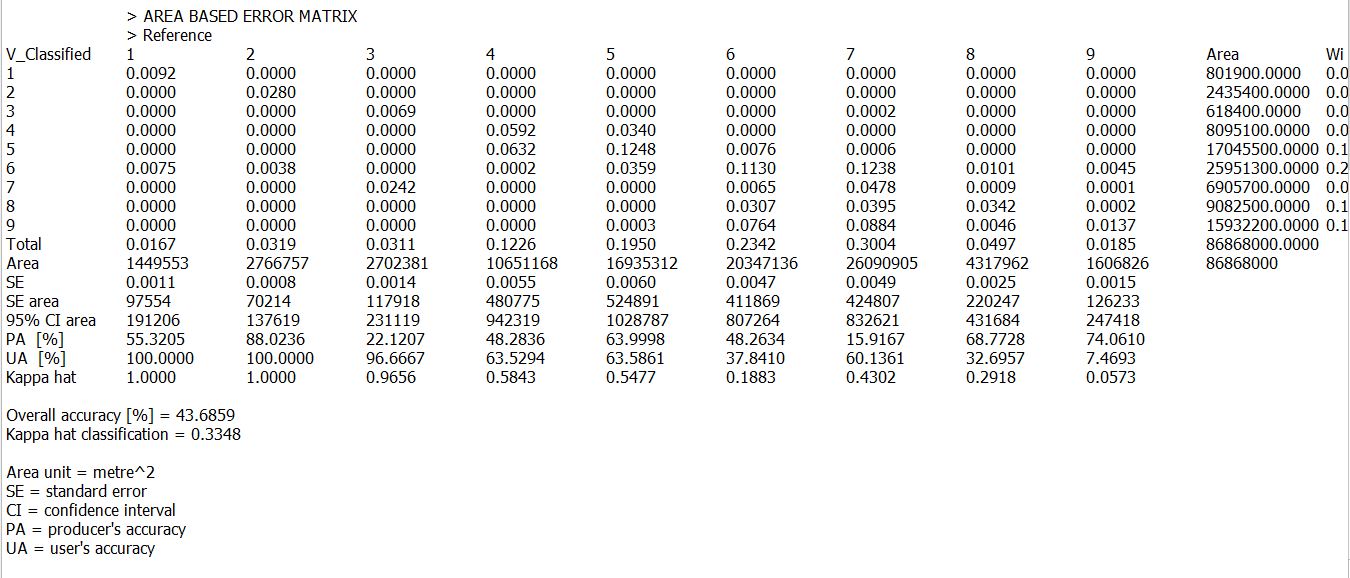
After classification, we need to check the integrity of our results and ensure that our final output is reliable. Accuracy assessment is done by comparing our classification results with ground truth data, which in this case our test samples. Test samples will then be compared with the train samples to the classification results in a confusion matrix. 2
Landsat 8
Pair-wise
Confusion Matrix
 Evaluation of confusion matrix
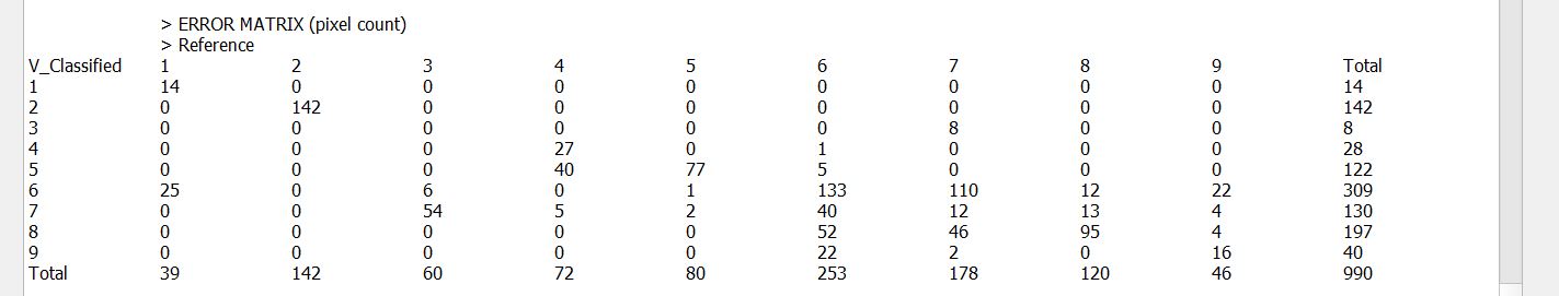
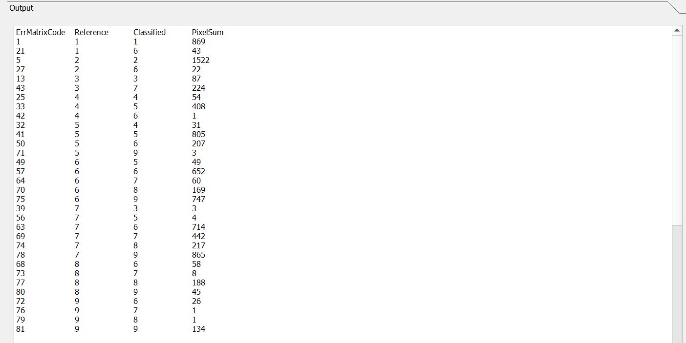
Based on the confusion matrix, we can see that Bare land, Built-up 2 and Impervious surfaces are doing poorly. As for the Built-up 3, Managed vegetation, Inland water, they are able to distinguish the respective classes well (> 70%).
Kappa Hat/Overall

Sentinel-2
Pair-wise
Confusion Matrix
 Evaluation of confusion matrix
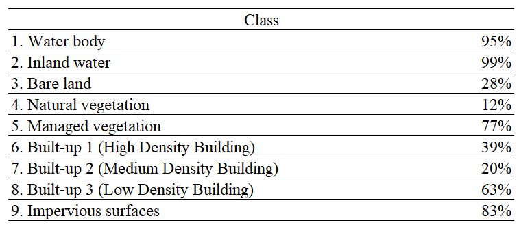
Based on the confusion matrix, we can see that Natural vegetation, Built-up 2 and Bare land are having difficulty differentiating, whereas Impervious surfaces, Water body and Inland water are able to differentiate amongst the pixels well.
Confusion Matrix 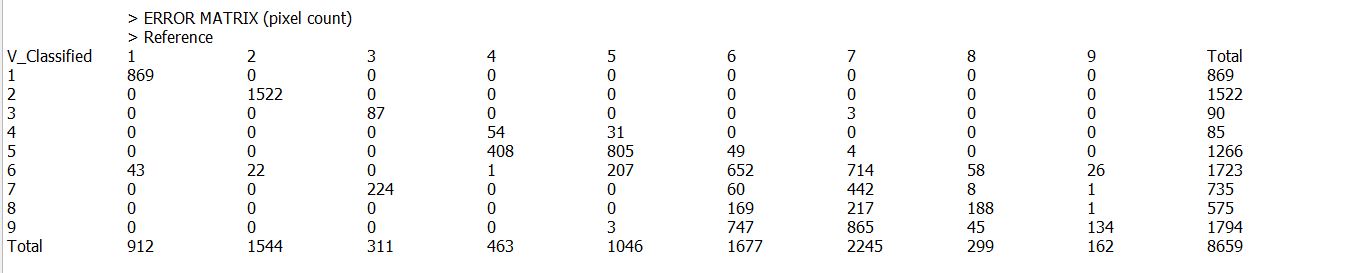
Kappa Hat/Overall
Footnotes
C Tucker D Grant & J Dykstra. NASA’s Global Orthorectified Landsat Data set. Photogramm. Eng. Rem. Sens. 2004, 70, 313-22.↩︎
Luca Congedo (2014) Accuracy Assessment Using Random Points and the Semi-Automatic Classification Plugin for QGIS, From GIS to Remote Sensing. https://fromgistors.blogspot.com/2014/09/accuracy-assessment-using-random-points.html↩︎