Findings
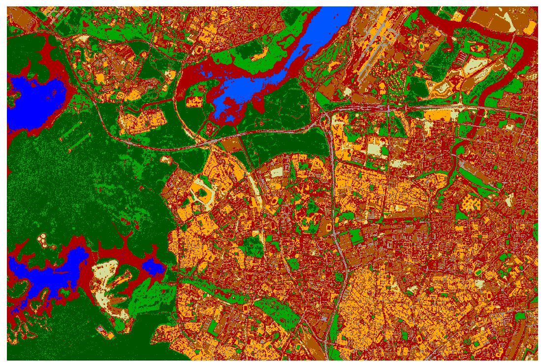
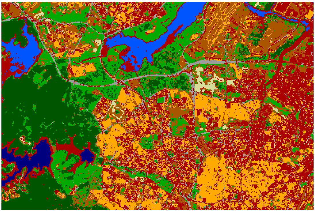
Overall
Results showed that the overall accuracy was 43.69% for Sentinel-2 while it was 51.24% for Landsat 8. Similarly the Kappa Hat classification was calculated 0.3348 and 0.4216 for Sentinel-2 and Landsat 8 respectively.
Water Bodies
In the case of water bodies, Landsat 8 performed better than Sentinel-2 as it managed to identify water bodies and Inland water.
Vegetation
Other than the misclassification of managed vegetation for bare land in Sentinel-2, we could see that Sentinel-2 effectively identified between Natural vegetation and Managed vegetation as compared to Landsat 8. Landsat 8 was rather sparse in the classification of vegetation, especially near the Seletar bus depot.
Discussion/ Future works
Both satellite imagery has their own benefits, with Sentinel-2 being clearer due to its spatial resolution and higher accuracy in classification for vegetation. On the other hand, Landsat 8 though lacking in spatial resolution, it performed better in terms of water body classification. We hope that the results would be useful for future land cover classification and a recommendation from us would be to merge Landsat-8 and Sentinel-2 imagery together to improve the overall accuracy
Literature Review
Our team has conducted several literatures reviews and found that out Sentinel-2A data has similar spectral bands and geometric accuracy to Landsat 8. (EROS, 2019) 1 Readings also suggest that when the red-edge bands in both datasets are being compared, a combination of both Landsat-8 and Sentinel-2 red-edge bands resulted in a higher accuracy index than Landsat-8 alone. (Gerald Forkuor et al, 2018)2
Therefore, we wanted to use the comparison study as an opportunity to explore the data insights that both datasets could be used to uncover.
Footnotes
USGS EROS Archive - Sentinel-2 - Comparison of Sentinel-2 and Landsat | U.S. Geological Survey. (2019, March 1). USGS.gov. From https://www.usgs.gov/centers/eros/science/usgs-eros-archive-sentinel-2-comparison-sentinel-2-and-landsat↩︎
Gerald Forkuor, Kangbeni Dimobe, Idriss Serme & Jerome Ebagnerin Tondoh (2018) Landsat-8 vs. Sentinel-2: examining the added value of sentinel-2’s red-edge bands to land-use and land-cover mapping in Burkina Faso, GIScience & Remote Sensing, 55:3, 331-354, DOI: 10.1080/15481603.2017.1370169↩︎